

Are you using Sanborn Maps for genealogy research?
Sanborn Fire Insurance Maps are a great resource for your research on North American geographic places, including tracing family businesses.
The Sanborn Map Company created and published of maps of U.S. cities and towns, and some in Canada and Mexico, over many decades. The maps were originally created for the insurance industry to assess fire liability in cities in the United States. Today the maps are a goldmine of information for local historical and genealogical research. They can be tricky to use at first, so here are some tips.
Search the Database
Search the Sanborn Fire Insurance Maps Online Checklist database of fire insurance maps held at the Library of Congress.
The online checklist contains links to existing digital images from LC’s collection and are updated as new images are scanned and added. If you have any questions, comments, or are interested in obtaining reproductions of maps not yet digitized, use LC’s Ask A Librarian feature.
The Sanborn maps are arranged by state, then city and release data. Currently there are over 25,000 sheets from over 3000 city sets online in the following states:
Alaska, Alabama, Arizona, California, Colorado, Connecticut, District of Columbia, Delaware, Georgia, Idaho, Illinois, Indiana, Kentucky, Louisiana, Maine, Massachusetts, Maryland, Maine, Michigan, Missouri, Mississippi, North Carolina, North Dakota, Nebraska, New Hampshire, New Jersey, Nevada, Ohio, Oklahoma, Pennsylvania, South Dakota, Texas, Virginia, Vermont, Wyoming, and Canada, Mexico, Cuba sugar warehouses, and U.S. whiskey warehouses.
Check Title Pages
Most editions of fire insurance maps contained prefatory material … which now has historic value in its own right. In particular, the map indexes and the descriptions of a city’s fire protection services of a city provide insights into various aspects of the development of urban America. The amount and nature of such introductory material varies widely from city to city and over time, reflecting changes in mapping policies of the Sanborn Map Company, the size of the city, and the rate of change within the city.
Small-town maps that comprised only a few map sheets were generally issued in loose-leaf format and did not have separate title pages. The first page of such editions, however, would include the names of the city, county, and state. The county name was important for differentiating towns of the same name within a state. It is important to note that because of divisions of counties or changes in county boundaries, a city may now be part of a county different from that in which it was originally mapped.
For large-city maps issued in one or more volumes, the title page often presents a visual delight of ornate typography and design. As cities became denser and larger over time, the Sanborn Map Company occasionally altered the presentation of the coverage of a city. A single volume could be divided: for instance, volume 1 from an edition in the late 1800s might become volume 1, North and volume 1, South in the 1920s. Also, the coverage of the suburban portions of a city could be shifted from volume to volume. Researchers need to be aware of such changes reflected in the titles to insure that they are using the volume that covers the portion of the city in which they are interested.
Check Sanborn Map Special Indexes

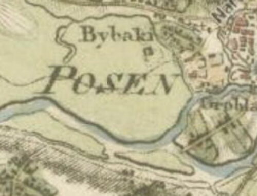
Courtesy LC Geography & Map Division
All Sanborn maps have a street index, but sometimes include a special index of specific properties. These indexes “identified major businesses, public buildings, factories, or other large structures. Such indexes were prepared to facilitate quick location of these major features. For current researchers, however, the list of “specials” is the equivalent of an abridged city directory that provides insight into the economic and social landscape of a community. From one edition of a city to another, entries in these indexes will come and go, and a particular business or institution will change its name to reflect new owners, a new function, or a modernized sense of propriety.”
Deciphering Publication Dates
For the first half century of fire insurance mapping, the dating of editions is generally straightforward. For small-town maps issued in loose-leaf format, the first page and generally each subsequent page carried the month and year of publication quite prominently in an upper corner of the map. The year of publication was usually repeated as part of the copyright notice that appeared as part of or adjacent to the title.
The dating of multi-volume editions of large-city maps is somewhat more complicated. The date on the first volume may be valid only for that particular volume, as the subsequent volumes may have been issued over a period of years. In several cases, a single volume within a multi-volume set was revised and reissued with a new date even before the whole edition was completed. In Fire Insurance Maps in the Library of Congress, therefore, date ranges are given for the coverage of multi-volume editions.
Try using Sanborn Maps for genealogy research. Click here to see other Sassy Jane posts about map research for genealogy. To give you an idea of what a full page looks like, here’s a map for Cripple Creek, Colorado, a gold-rush boom town.

Leave a Reply